Please be advised this is a working draft. I am still in the process of adding new content and editing.
What is “rural”? This is a question the professor asked our class on the first day of Rural and Regional Economic Development. At first I was befuddled by this question. Here is my original response to her question.
Having grown up in a rural area I had always operated on the assumption that places that looked like where I lived were rural, and places that don’t look like where I live are urban. But how do you mark the boundary between urban and rural without having a more precise definition? Are rural and urban binary conditions, or a continuum with varying degrees of urban and rural land-use that may coexist? Is their one way to urbanize, or are there many possible ways? Why do some urban / rural places “work” and other urban / rural places “don’t work”? Is urbanization the inevitable goal of human settlement, or is it merely a transition towards something else? These are questions that I did not address in my original response, but I would like to explore these questions a little further in this post.
South Portland may not seem like a rural place, but when my mother was a kid she lived in South Portland and worked on farms over the summer. Perhaps some of those farms were in Cape Elizabeth, but the distinction between South Portland and Cape Elizabeth is relatively recent.
 |
| Source: Cape Elizabeth: Past to Present |

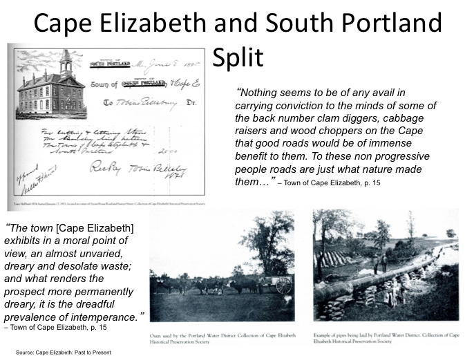
South Portland officially separated from Cape Elizabeth in the 1890s over a dispute about public water, but this was dispute had been building up for several decades. As the area now known as South Portland became more urbanized, they began to distance themselves from the more rural Cape Elizabeth.
 |
| Source: UNH Dimond Library |
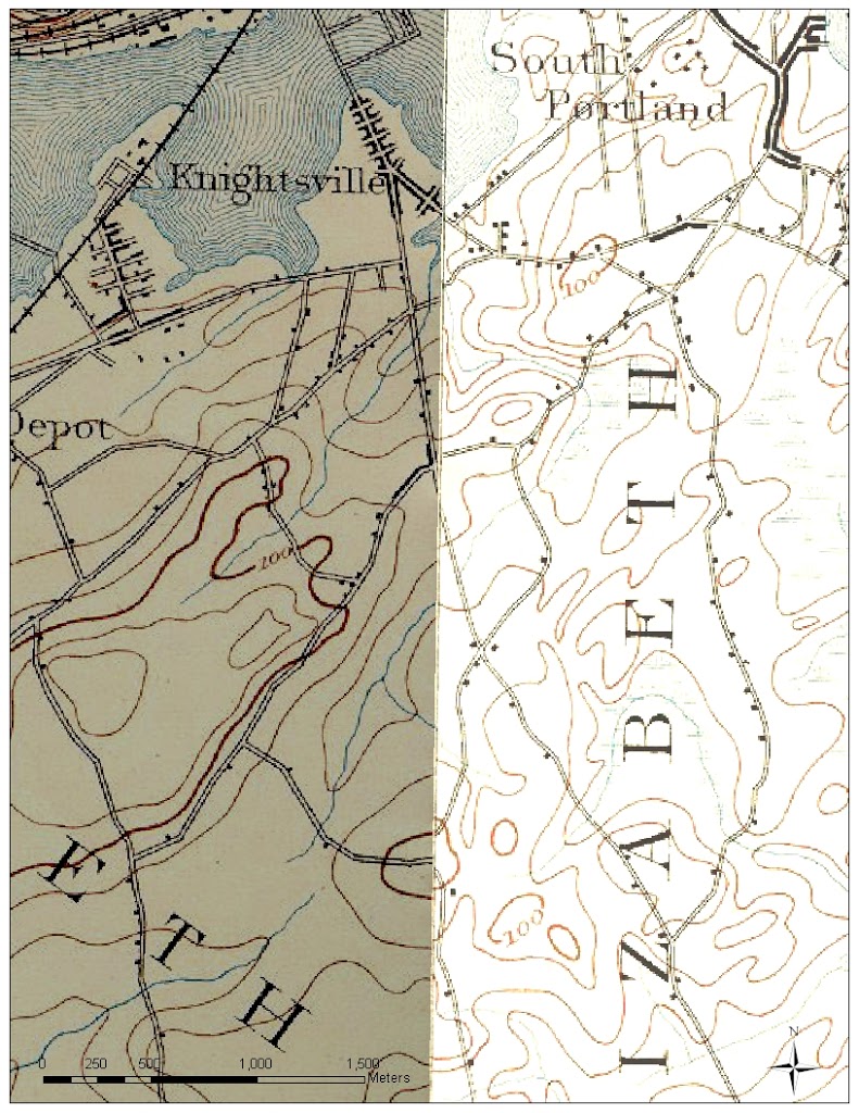
This 1890s USGS map shows a division between South Portland and Cape Elizabeth, although that division wasn’t made official until South Portland officially splits from Cape Elizabeth over a dispute about extending the Portland Water district lines to South Portland.
The farmers on the Cape didn’t want to pay higher taxes for public water, while the urban residents of the northern part of town saw public water as a symbol of progress and something that would tie them to Portland. Ironically, within 10 years of this separation the PWD waterlines were extended to Cape Elizabeth.
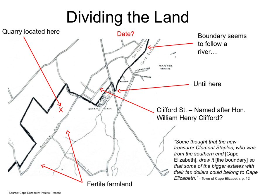
When the boundary was drawn between South Portland and Cape Elizabeth it created a valuable piece of suburban real estate. The close proximity to Portland provided access to urban amenities, such as public water and sewer, public transportation, and jobs, while the close proximity to Cape Elizabeth provided rural recreational opportunities on the weekend.
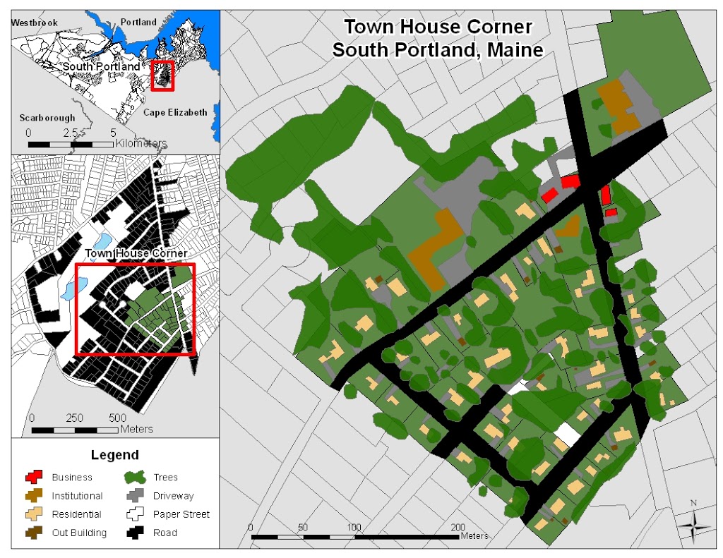 |
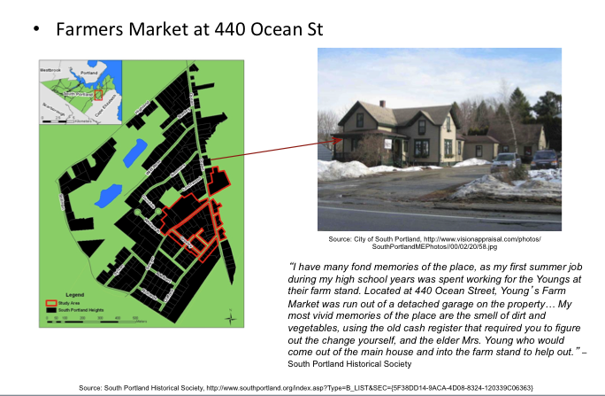
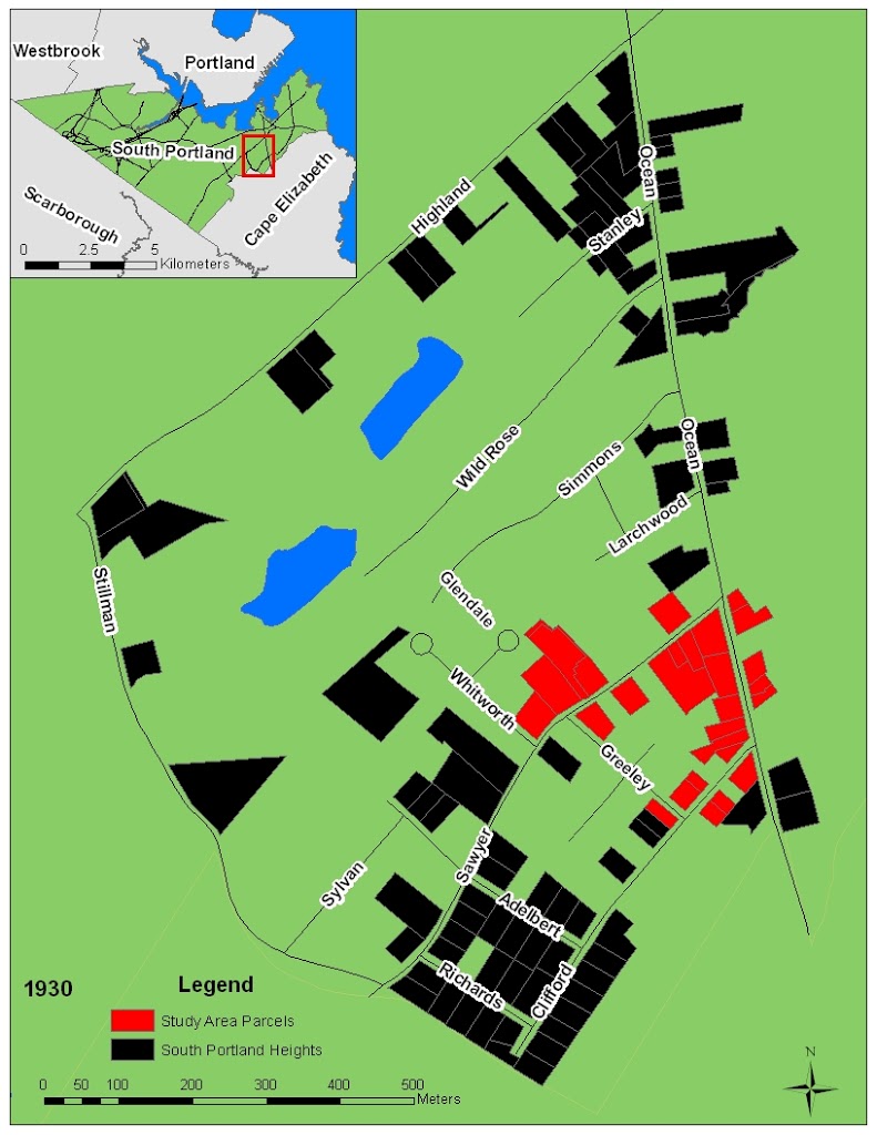
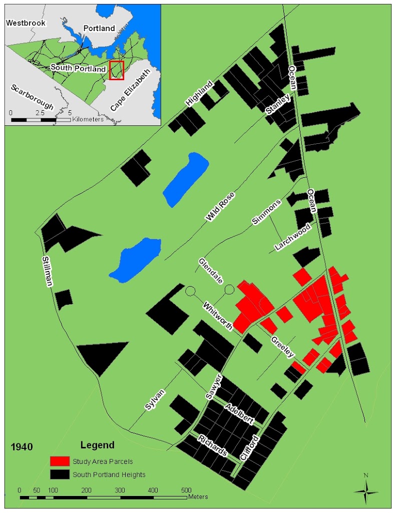
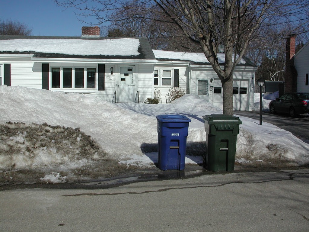
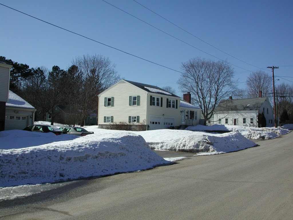
I used to deliver newspapers in many neighborhoods in Portland, Westbrook, Scarborough, and South Portland, but by far my favorite neighborhood to deliver in was in South Portland on Ocean Ave. between Highland Ave. and the Cape Elizabeth line, especially between Sawyer St. and Clifford St. I always really liked this neighborhood, but I couldn’t figure out why until I looked at the assessment data on South Portland’s website. The assessment data show the year each parcel in town was developed. I did a project for a class where I took these data and constructed maps showing how this neighborhood developed. There are sure to be some errors in the assessment data, but generally the assessment data tell a very interesting story of how this neighborhood grew.
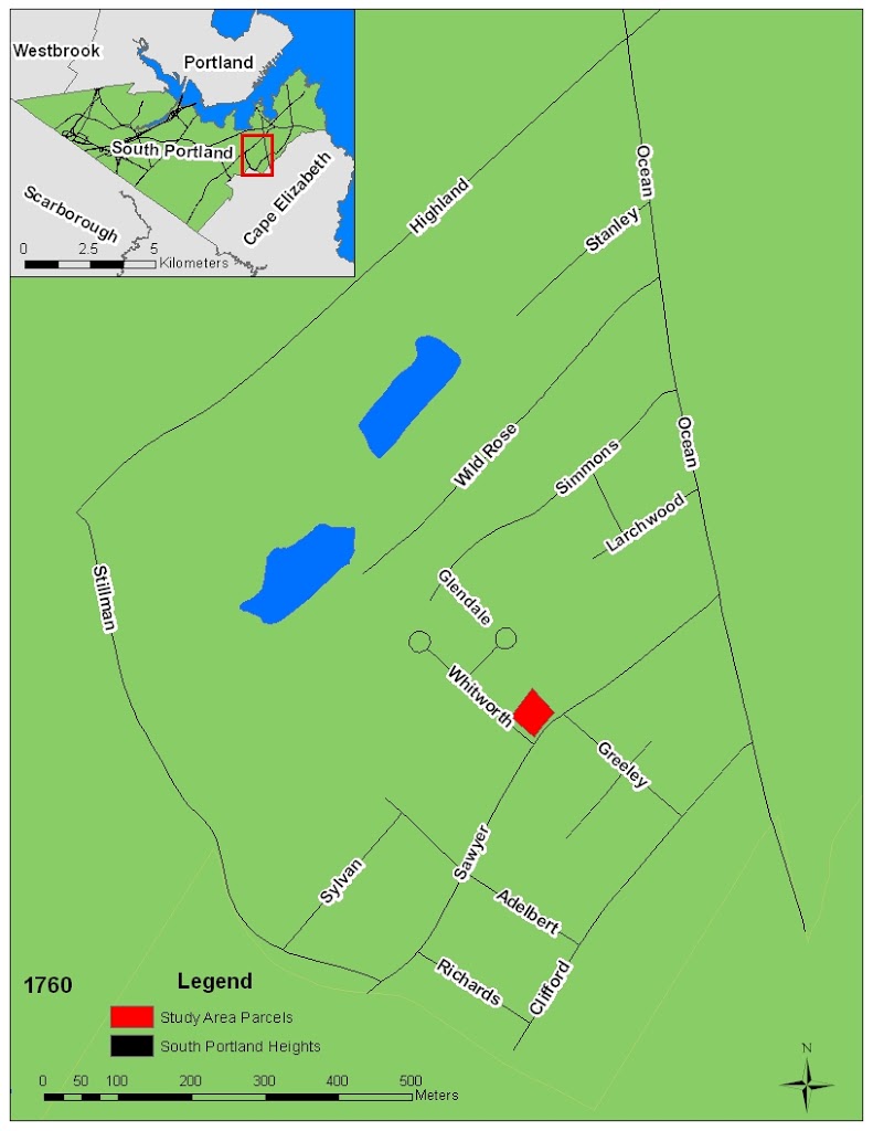
This map shows the neighborhood as it may have existed in 1760. There is one house. Clearly, this is rural South Portland.
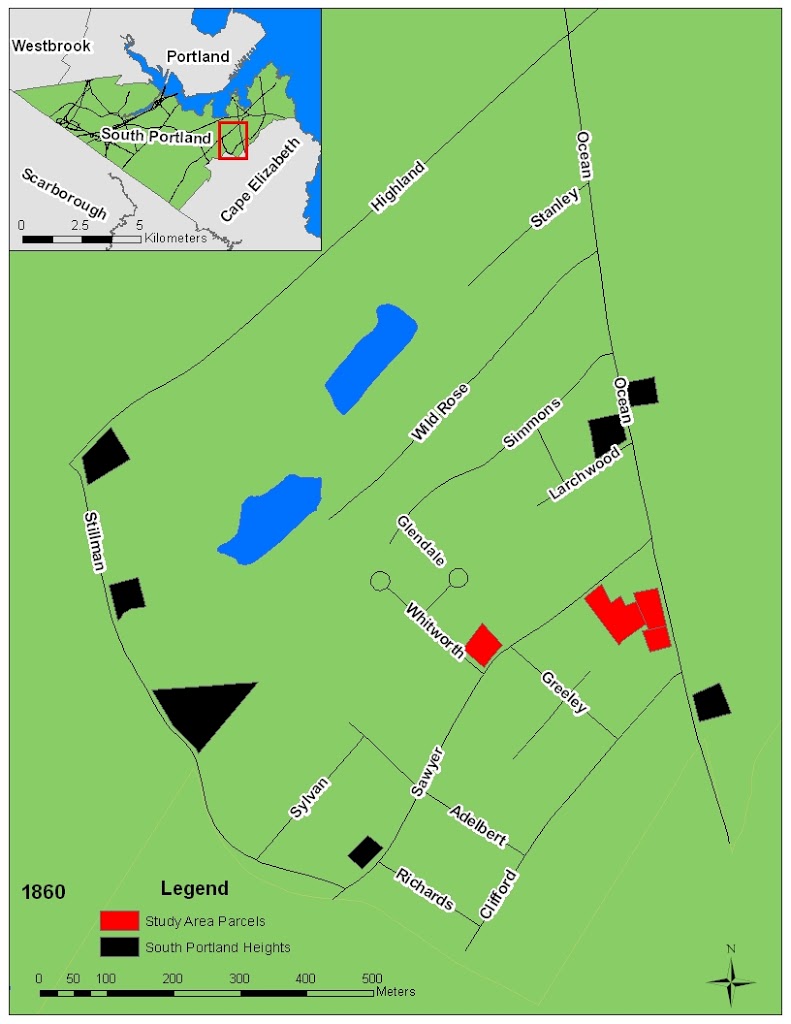
This map shows the neighborhood in 1860. There are more houses, but clearly this is still rural South Portland.
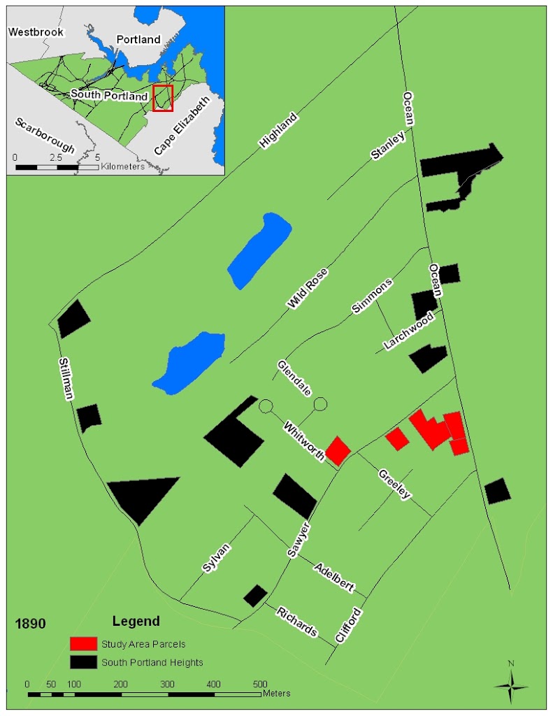
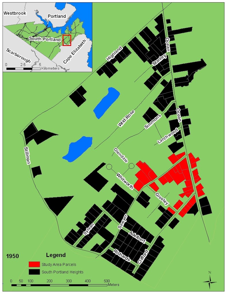
This map shows the neighborhood in 1890. There has been growth since 1860, but clearly this is still rural.
189x – public water brought to South Portland
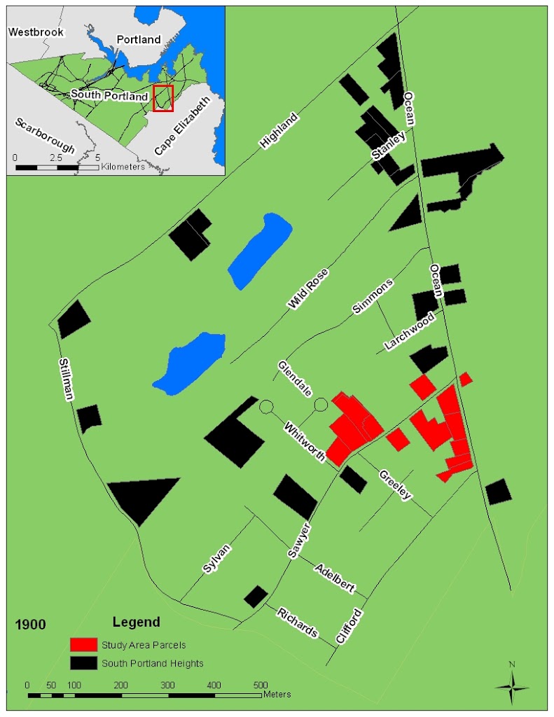
This map shows South Portland just a few years after public water and sewer were brought in. This neighborhood became a haven for the upper middle class seeking to escape the urban horror. The public water made higher density development possible, and the electric streetcar made this an ideal location to live because one could commute to work in Portland during the week and recreation in Cape Elizabeth on the weekends.
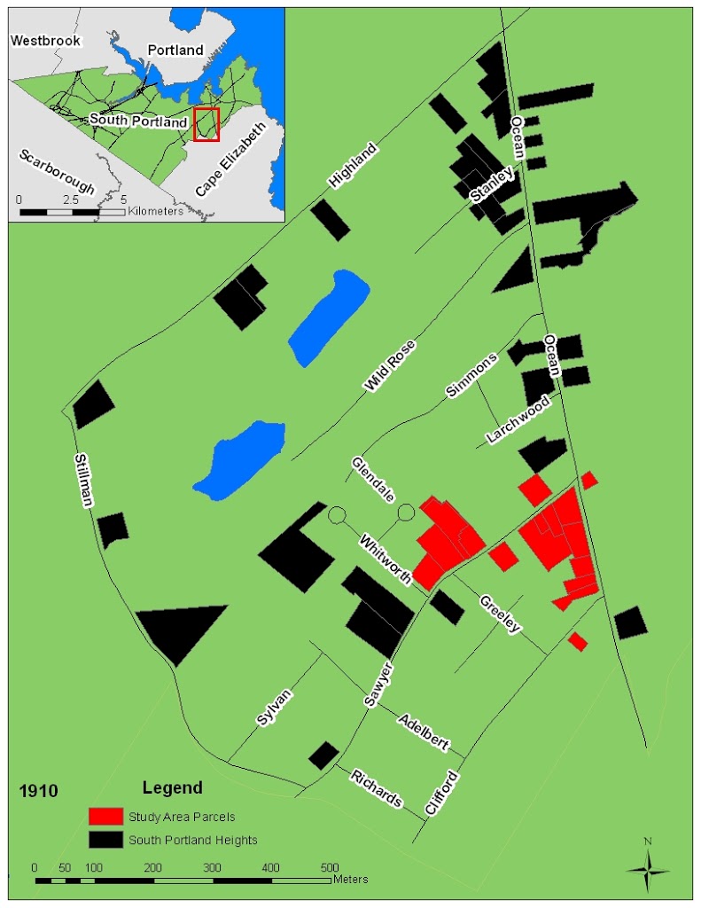
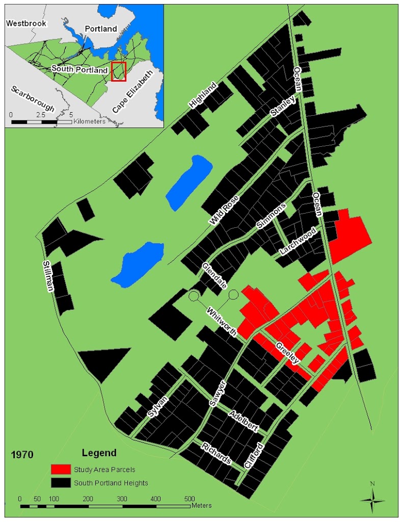
Growth continued through the first decade of the 20th century.
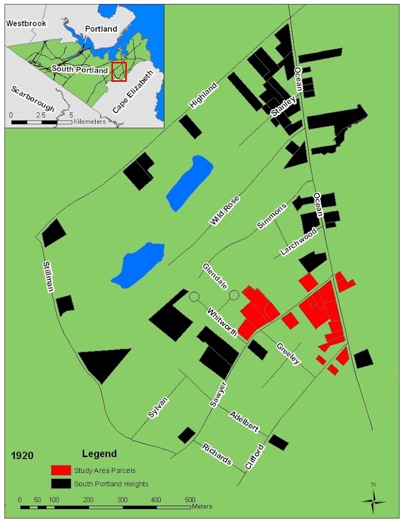
1913 Federal Income Tax enacted
WW I
Growth slowed in the 1910s
Banks began to invest in housing to avoid paying income tax.
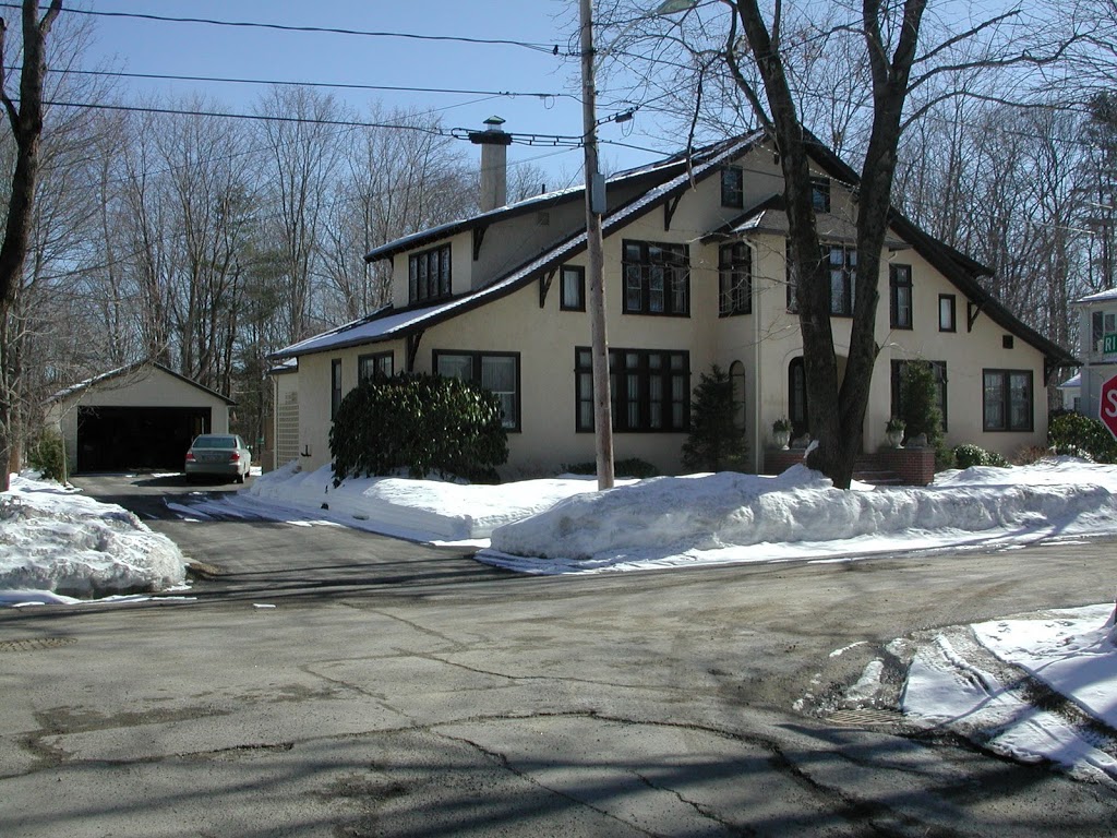
Housing growth picked up dramatically during the 1920s.
Then crashed in the 1930s.
The New Deal
After 1930 a new type of home emerged: the affordable home.
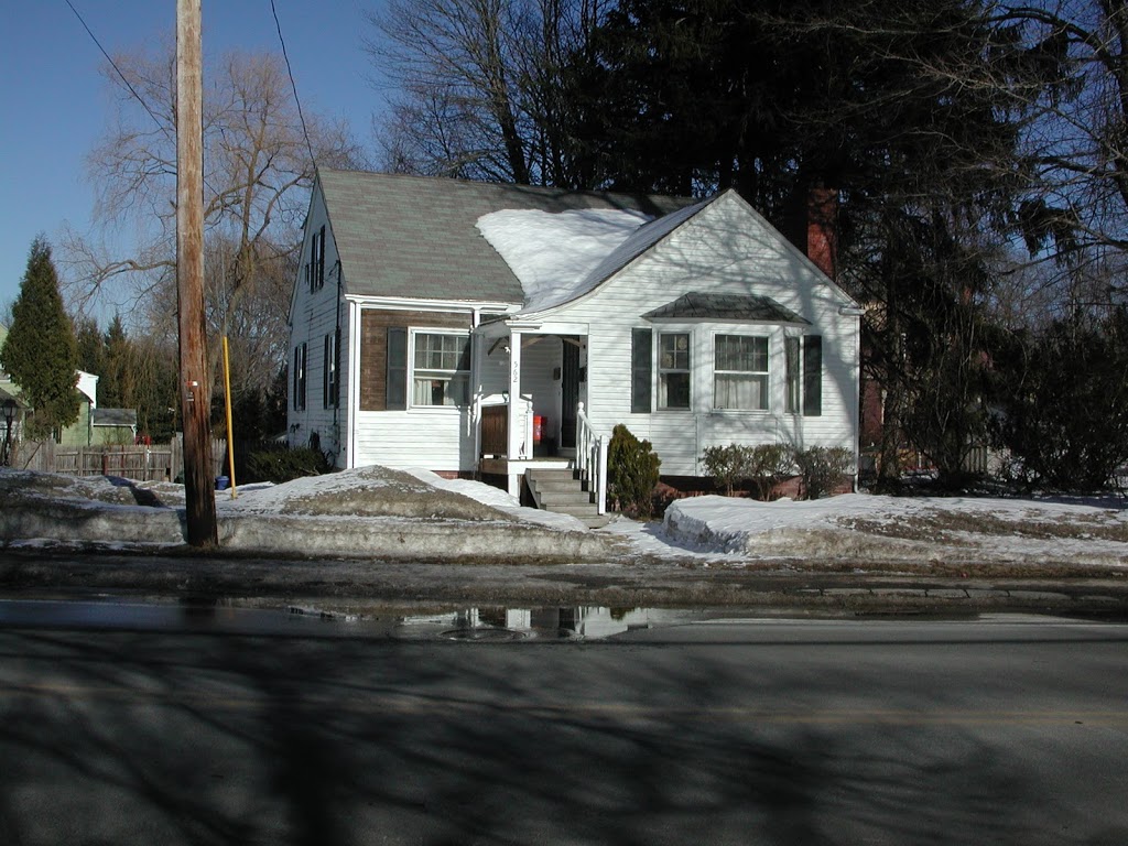
These homes were affordable, but not nearly as appealing as some of the homes built prior to 1930.

1940s
The Post WW II Housing Boom
The GI Bill
Shared Prosperity
1950s

The garage becomes more integrated with the home:
 |
| “Cars live here, people just rent the upstairs.” |
1960s
Subdivision boom continues
1970s
Supply of build-able land diminishes
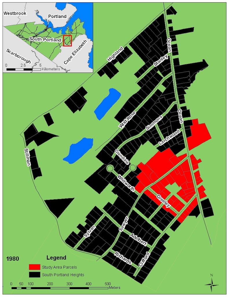
1980s
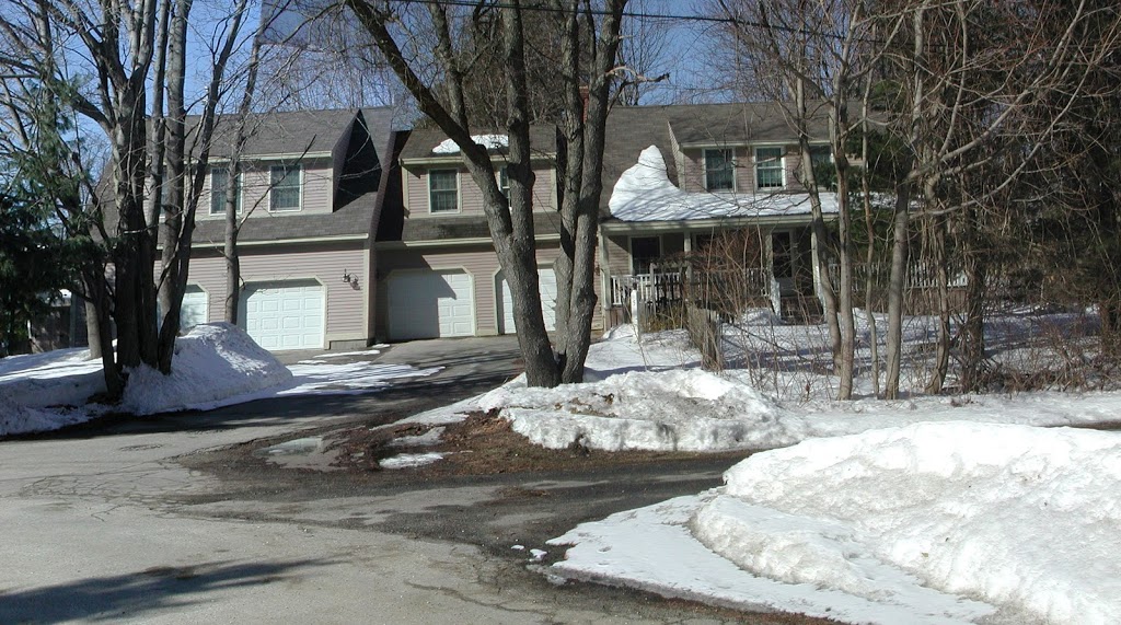
Mortgage interest tax credit makes 4 car garages affordable
2000s
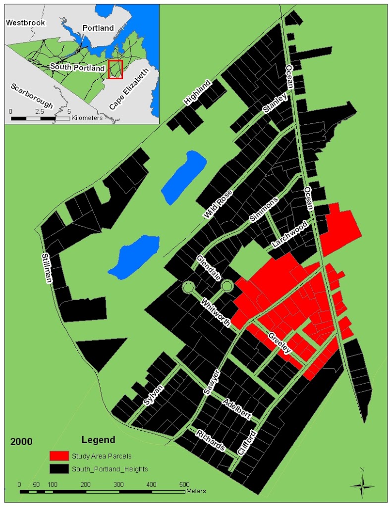
no build-able land left
This neighborhood in South Portland was at one time rural, but it has made a graceful transition to urban. The question still remains to be answered: when did this part of South Portland stop being rural and start being urban?
I suppose there are many different technical definitions of urban or rural that one could use to answer this question, but I don’t think those definitions really capture the true essence of what rural means. Even though this neighborhood has become very urban, there are still various relics or clues that remain in the neighborhood to remind us of its rural past. The journey from rural to urban is often presented as a journey of inevitable progress, but some see it as a search for balance in the design of the communities that we live and work in. This neighborhood is a place that works because it has achieved a favorable balance between rural and urban, and it may serve as an example for other rural communities that are faced with urban growth pressures.
Excellent historical perspective on the transition from rural to suburban. You spend a great deal of time creating graphics that give the reader some excellent insight into what is going on places like this and the relationship to Federal Housing Policy. Keep going!
Scott